
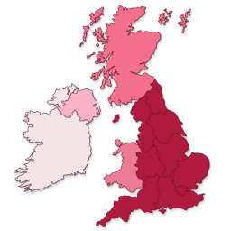
INTERACTIVE UK REGIONAL MAP
Interactive UK Regional Map compatibility with REEID Translate
Interactive UK Regional Map compatibility with REEID Translate is being reviewed using official plugin documentation. Displays an interactive SVG-based map of the UK and Ireland with clickable regions for England, Northern Ireland, Scotland, Wales, and Ireland. No specific text shown to visitors is currently confirmed for translation.
AWAITING VERIFICATION
What Interactive UK Regional Map does
Official plugin information supports the compatibility context documented for this category.
MANUAL REVIEW
This integration has not yet been manually verified by REEID.
PLUGIN PROFILE
Interactive UK Regional Map is documented in the Other category with 7 documented features.
DOCUMENTATION REVIEW
We use official plugin documentation to describe what the plugin does. Translation support is listed only for text that can be identified and tested.
COMPATIBILITY REVIEW
How Interactive UK Regional Map compatibility is evaluated
01 · Review official plugin documentation
Confirm documented plugin behaviour before making multilingual compatibility claims.
02 · Identify text shown to visitors
Check whether the documented features display text that visitors can read.
03 · Separate content from functionality
Structure, settings, logic, integrations and runtime behaviour are not treated as translatable content unless they include specific visible text.
04 · Confirm what can be translated
List supported content only after specific text shown to visitors has been identified and can be validated.
PLUGIN INFORMATION
What the plugin does
Plugin capabilities
- Displays an interactive SVG-based map of the UK and Ireland with clickable regions for England, Northern Ireland, Scotland, Wales, and Ireland.
- Provides a dedicated WordPress admin panel interface for customizing region colors, links, and hover descriptions without requiring coding knowledge.
- Supports embedding the map via shortcode `[ukr_map]` in any page or post.
- Allows independent configuration of each region, including setting specific regions to inactive status.
- Enables customization of hover popups to include text and images.
- Offers bulk editing capabilities for managing multiple region settings efficiently.
- Ensures responsive design compatibility across desktop, smartphones, tablets, and other mobile devices.
TRANSLATION BOUNDARY
Interactive UK Regional Map capabilities and translatable content are documented separately.
Official documentation describes the plugin functionality, but does not currently identify specific text shown to visitors that can be translated.
A feature is not considered translatable unless it includes text that users can read.
LIMITATIONS & QA
Verification notes
- This integration is documented for compatibility. No specific content shown to visitors is confirmed for translation in this category.
FREQUENTLY ASKED QUESTIONS
Interactive UK Regional Map and REEID Translate FAQ.
What does Interactive UK Regional Map do?
Interactive UK Regional Map has 7 documented features listed in its official documentation. See the Plugin Information section for details.
Does Interactive UK Regional Map have any content currently confirmed for translation?
No specific content is currently confirmed for translation in this integration.
What needs to be confirmed before translating content from Interactive UK Regional Map?
Official documentation must identify specific text, such as labels, titles, descriptions or messages, that can be tested in the integration.
RELATED GUIDES
Explore more compatibility guides.
COMPATIBILITY INFORMATION
Evaluate Interactive UK Regional Map in a multilingual WordPress workflow.
REEID documents Interactive UK Regional Map functionality separately from confirmed translation support so the distinction is clear.
Supported content will be listed when specific translatable text is identified in the official documentation.