
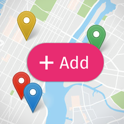
OPEN USER MAP
Open User Map – Interactive Leaflet Maps compatibility with REEID Translate
Open User Map – Interactive Leaflet Maps compatibility with REEID Translate is being reviewed using official plugin documentation. Creates custom interactive maps for WordPress using Leaflet-based map styles. No specific text shown to visitors is currently confirmed for translation.
AWAITING VERIFICATION
What Open User Map – Interactive Leaflet Maps does
Official plugin information supports the compatibility context documented for this category.
MANUAL REVIEW
This integration has not yet been manually verified by REEID.
PLUGIN PROFILE
Open User Map – Interactive Leaflet Maps is documented in the Navigation category with 8 documented features.
DOCUMENTATION REVIEW
We use official plugin documentation to describe what the plugin does. Translation support is listed only for text that can be identified and tested.
COMPATIBILITY REVIEW
How Open User Map – Interactive Leaflet Maps compatibility is evaluated
01 · Review official plugin documentation
Confirm documented plugin behaviour before making multilingual compatibility claims.
02 · Identify text shown to visitors
Check whether the documented features display text that visitors can read.
03 · Separate content from functionality
Structure, settings, logic, integrations and runtime behaviour are not treated as translatable content unless they include specific visible text.
04 · Confirm what can be translated
List supported content only after specific text shown to visitors has been identified and can be validated.
PLUGIN INFORMATION
What the plugin does
Plugin capabilities
- Creates custom interactive maps for WordPress using Leaflet-based map styles.
- Supports frontend marker submissions with optional approval before publishing.
- Can be used as a simple custom map without visitor submissions.
- Includes marker search, address search, and category filtering.
- Supports Gutenberg blocks, Elementor widgets, and shortcodes for embedding maps.
- Can organize locations with custom fields and media such as images, audio, and videos.
- Supports regional navigation tabs for maps covering multiple cities, countries, or large areas.
- Offers marker clustering and options to limit visible locations by categories or post IDs.
Distinctive features
Leaflet-based interactive maps with frontend marker submission, optional approval before publishing, regional navigation tabs, marker clustering, and location organization with custom fields plus image, audio, and video media.
TRANSLATION BOUNDARY
Open User Map – Interactive Leaflet Maps capabilities and translatable content are documented separately.
Official documentation describes the plugin functionality, but does not currently identify specific text shown to visitors that can be translated.
A feature is not considered translatable unless it includes text that users can read.
LIMITATIONS & QA
Verification notes
- Evidence is limited to the plugin’s stated map and marker features. Compatibility with translation workflows is not established. Behavior on specific machine surfaces should be treated individually; the available evidence mentions Gutenberg blocks, Elementor widgets, and shortcodes, but does not establish broader compatibility beyond those surfaces. No evidence was provided for forms, commerce, or SEO/metadata handling.
FREQUENTLY ASKED QUESTIONS
Open User Map – Interactive Leaflet Maps and REEID Translate FAQ.
What does Open User Map – Interactive Leaflet Maps do?
Open User Map – Interactive Leaflet Maps has 8 documented features listed in its official documentation. See the Plugin Information section for details.
Does Open User Map – Interactive Leaflet Maps have any content currently confirmed for translation?
No specific content is currently confirmed for translation in this integration.
What needs to be confirmed before translating content from Open User Map – Interactive Leaflet Maps?
Official documentation must identify specific text, such as labels, titles, descriptions or messages, that can be tested in the integration.
RELATED GUIDES
Explore more compatibility guides.
COMPATIBILITY INFORMATION
Evaluate Open User Map – Interactive Leaflet Maps in a multilingual WordPress workflow.
REEID documents Open User Map – Interactive Leaflet Maps functionality separately from confirmed translation support so the distinction is clear.
Supported content will be listed when specific translatable text is identified in the official documentation.